
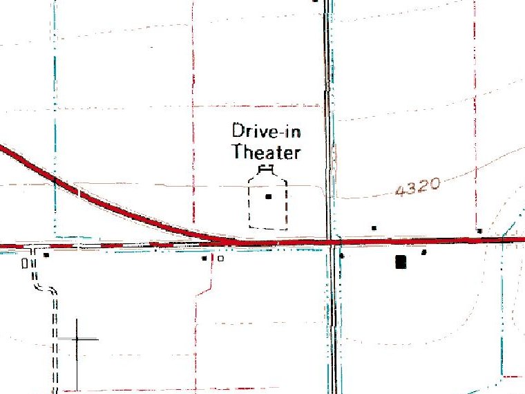
Moonlite Drive-In
Aerial Photos
Aerial Photos
Courtesy of the US Geological Survey, 1 July 1991
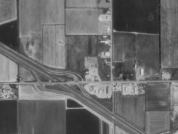
Courtesy of the US Geological Survey, 23 September 1993
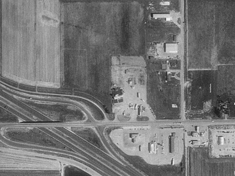
Courtesy of the US Geological Survey, 23 September 1993